

Share
9 of the best hiking routes in Norway, where rare beauty awaits

Kerry Walker
Aug 16, 2022 ‚ÄĘ 11 min read
Share

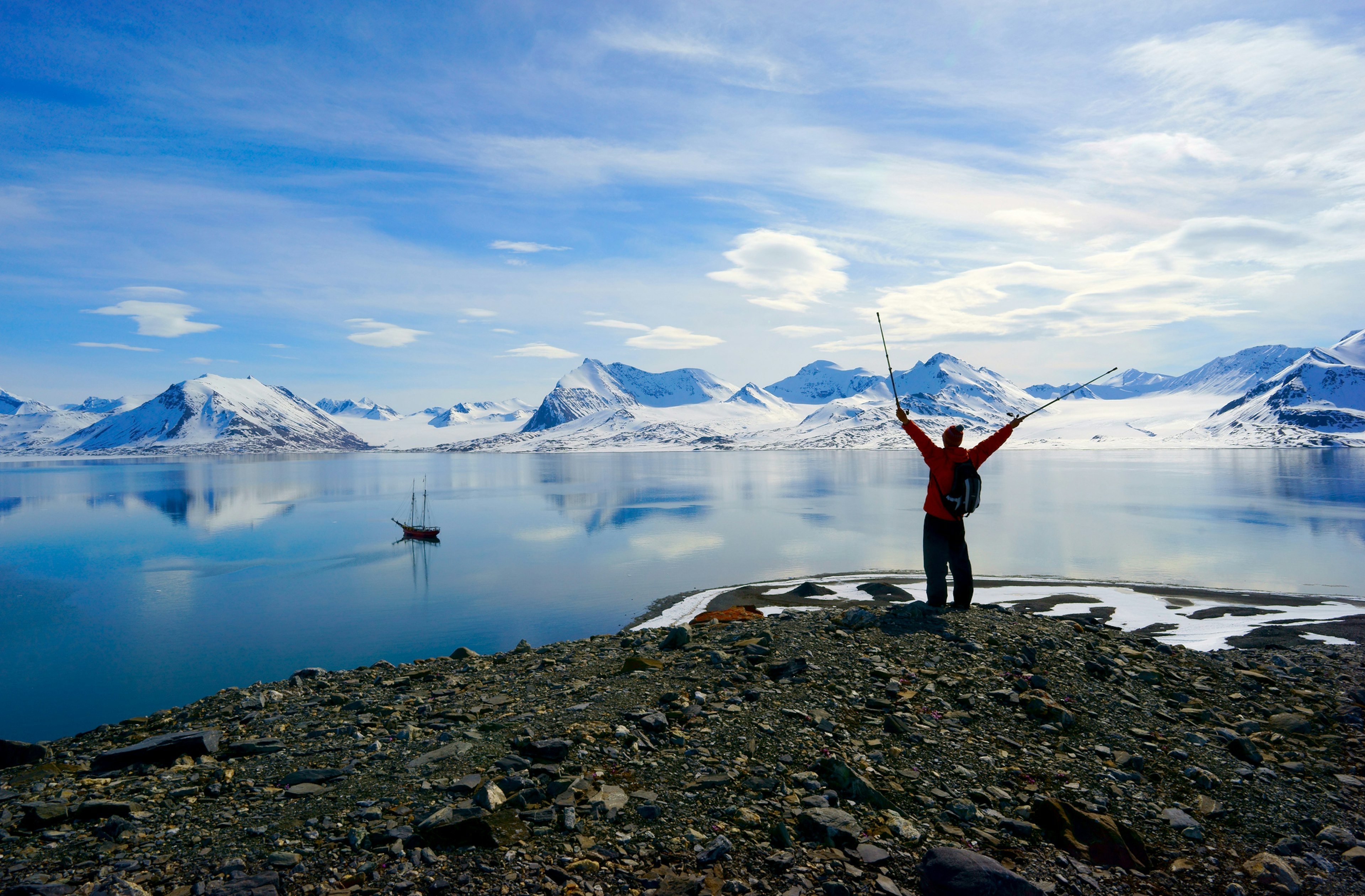
Here are some of Norway's stunning hiking routes and trails © Roberto Moiola / Getty Images
In a country that prizes friluftsliv (outdoor living) above all else, the Norwegians have a headstart when it comes to hiking.
This spectacularly buckled and contorted land of jewel-colored fjords, glaciers and pop-up mountains is best seen by hitting the trails that wriggle through its remotest reaches, where you’ll receive the wildest of welcomes. Bring a compass and a map, clothes for whatever Norway's weather gods can throw at you and be prepared to jump in at the deep end.
What rare beauty awaits! Whether you’re clambering up ludicrously sheer rock walls as dawn lights up the fjords, surmounting Alpine peaks on a hut-to-hut trek in a national park where wild reindeer roam, or testing every ounce of strength and stamina in your body on a long-distance hike in the arctic, Norway will win your heart with one-of-a-kind nature that can only be seen on foot. These nine hikes whet the appetite, but they really are just the tip of the iceberg.

Preikestolen
Best cliff-hanger of a hike
8km (5 miles) round trip, 4 hours, moderate
At the top of Norway‚Äôs charts of don‚Äôt-dare-look-down, gasp-out-loud, razor-edge rock formations is Pulpit Rock ‚Äď a 604m-high (1981ft) finger of granite rock, hammered into shape by glacial forces during the last Ice Age. Jutting up above the blue ribbon of Lysefjord near Stavanger, this iconic fist of rock is phenomenally beautiful no matter the weather (rain, fog, snow ‚Äď you name it).
The good news: it isn’t as brutal to hike up as some of the country’s other rock stars, though neither is it a walk in the park. You’ll head up a boulder-strewn trail that can be steep, boggy, windy and exposed in places, with no fences or barriers to stop you blowing off the cliffs. The trail starts at Preikestolen Fjellstue mountain lodge.
Fame has gone to Preikestolen’s head somewhat and we can’t deny that this is hands-down one of Norway’s most popular hikes, so if you want to dodge the selfie-stick-waving crowds after the perfect look-at-me-dangling-on-the-edge-of-death Instagram shot, go in the shoulder season (late spring/early fall). Or even better, get a head-start by staying the night at .
Note: to teeter too close to the edge is to risk life and limb. The hike is generally doable from May to September; in winter you’ll need a guide.

≥“≤ĻĪŰĽŚ≥ů√łĪŤĺĪ≤Ķ≤ĶĪū≤‘
Best summit climb
11km (17.5 miles) round trip, 5‚Äď7 hours, demanding
We get it: you‚Äôve made it all the way to the glacier-encrusted, mountain-rippled feast of a national park that is Jotunheimen ("Home of the Giants"), so why wouldn‚Äôt you go the extra mile and clamber to the summit of Norway‚Äôs highest peak, 2469m (8100ft) ≥“≤ĻĪŰĽŚ≥ů√łĪŤĺĪ≤Ķ≤ĶĪū≤‘? Choose a good day and you‚Äôll feel like a god surveying all creation from the top, with arresting views of Jotunheimen‚Äôs sea of dark, snow-dusted peaks and jewel-colored lakes and a sizeable chunk of Southern Norway.
Numerous trails lead to the top, but the easiest one to access begins a 30-minute drive from the village of Lom at way-above-the-treeline cabin, Northern Europe’s highest mountain lodge at 1840m (6037ft). Stay the night here for an early start to sidestep the crowds. From here, you’re plunged straight into proper wilderness on a trail that requires a good level of fitness, a sure-footed step and plenty of stamina, snaking up through boulders and involving a roped traverse of the Styggebreen glacier. The glacier crossing means you’ll need a , but wow it is special.
Styggebreen translates inaptly as "ugly glacier", but ‚Äď as your guide will delight in telling you ‚Äď "stygg" in this context refers to local dialect meaning "dangerous". Cross the frozen white expanse of the glacier and ≥“≤ĻĪŰĽŚ≥ů√łĪŤĺĪ≤Ķ≤ĶĪū≤‘ sweeps up before you like a shark‚Äôs fin, before a stiff, snowy ascent to the summit. Weather permitting, the hike is doable from late May to mid-September.

Trolltunga
Best hike for fjord views
28km (17.5 miles) round trip, 10‚Äď12 hours, demanding
You might imagine a rock with a name like Trolltunga (Troll‚Äôs Tongue) to be a bit of a beast and it is ‚Äď but it‚Äôs also a beauty. In the country‚Äôs southwest, this vertiginous spur of rock rises 1180m (3871ft) above sea level, projecting into the void above the brilliant blue, mountain-rimmed Lake Ringedalsvatnet.
Getting up here involves a gruelling, full-day ascent, but reaching the top is like standing at the edge of a diving board ‚Äď scary and heart-skippingly thrilling in equal measure. As tempting as it may be, whatever you do, don‚Äôt jump. Trail highlights are many but you‚Äôll never forget clapping eyes on Tyssestrengene, one of the world‚Äôs tallest waterfalls, with a freefall of 300m (984ft) and a total height of 646m (2119ft).
This hike is a toughie, demanding a solid level of fitness and the right gear (warm wind- and waterproof clothes, decent boots, an emergency bivouac in case the weather turns vile, sunglasses, a headlamp, food, water and first aid kit). The route can be steep and exposed, with no barriers or fences to stop you taking a tumble off the cliffs. As such, it’s one for good weather (check forecasts before heading out).
Start before 8am to guarantee you complete the hike before nightfall. The route is doable from June to early September. From October to May, you’ll need to enlist a guide that knows the snow, such as Trolltunga Active, that offers some excellent sunrise and sunset options. The trailhead is in Skjeggedal, 13km (8miles) northeast of Odda.

ĪŠ√•Īū≤‘
Best easy hike
10km (6.2 miles) round trip, 2‚Äď3 hours, easy
The "wow" never leaves your lips on this short-but-sweet hike on the island of V√¶r√ły (Vaeroy) in the Lofoten archipelago. From the 451m (1480ft) summit of ĪŠ√•Īū≤‘, or H√•heia, you might well ask yourself what magical forces were at play when this island was created.
From here the view will leave you utterly speechless, taking in the island’s shaggy green cliffs that curve like a dragon’s backbone above scalloped bays of powder-white sand, fizzing into a sea fading from turquoise to sapphire blue. It’s a view to commit to memory and one that is surprisingly easily earned on this fairly gentle, family-friendly hike. On cloudless days, you can glimpse the Norwegian mainland and Svartisen (Norway’s second largest glacier) in the distance.
You can only reach V√¶r√ły by ferry. The trail begins in S√łrland and it‚Äôs a steady march to the summit. Kids can manage this one too, but take care on the cliffs at the top. As you pick your way uphill, keep an eye out for restored eagle houses. In past times, locals used to catch eagles with their bare hands by hiding in these stone houses.

Kjeragbolten
Best boulder hike
11km (6.8 miles) round trip, 6‚Äď10 hours, demanding
It’s often billed as a mountain climb but, trust us, that ain’t what it looks like. In a country full of mad rocks, 1084m (3556ft) Kjeragbolten is all-out bonkers: a glacial boulder jammed in a crevice between two heart-stoppingly sheer cliffs punching way above the true-blue expanse of Lysefjord.
But if you‚Äôre up for a challenge and view that ranks among Norway‚Äôs most sublime, sign up right here. The hike can be steep, muddy and tough, with 800m (2624ft) of elevation gain and three ridges to negotiate, and some areas where you have to slip and slide with the assistance of cables. The scary bit comes when you reach the boulder itself and have to cross a breathtakingly exposed ledge to step ‚Äď or crawl onto it. You can see why hardcore climbers and base jumpers get their kicks here.
It‚Äôs a full day walk and getting here independently isn‚Äôt easy, so you might want to enlist a to help with the hike and logistics. The trail begins from √ėygardsst√łlen car park, near the highest hairpin bend above Lysebot. Car park staff can give you the heads-up on current conditions. Rain and snow can be treacherous as the trail gets very slippery. Ordinarily, the trail is hikeable from mid-May to September (snow can render it inaccessible in winter).

Rondane Triangle Route
Best multi-day hike
50km (31 miles) round trip, 5 days, demanding
Cabin-to-cabin is the way to go in the granddaddy of Norwegian national parks, , home to some of the country’s most splendid Alpine terrain. This five-day hike takes a headfirst dive into the remote, staggering wilderness of the 963-sq-km (372-sq-mile) national park, one of the last refuges of wild reindeer (and also home to bears, lynx, moose, musk ox and wolves).
The trek is divided roughly up into 10km (6.2-mile) bite-sized chunks, taking you from hut to gloriously perched hut, for soul-stirring views of sunsets and sunrises over glaciated mountains. You’ll be hiking across barren, lichen-covered plateaux, stopping every so often to gawp at waterfalls, lakes, fast-rushing rivers and peaks topping the 2000m (6562ft) mark.
Crowds are relatively few, making hiking here feel like a proper adventure. The trailhead is in Spranget, reached by bus from Otta, the nearest town.
Nordkalottruta
Best long-distance hike
800km (497 miles), 45‚Äď50 days, demanding
If you want to pit yourself against raw wilderness and bitter cold, push boundaries and relish utter solitude, this epic long-distance hike taking in the full sweep of the arctic north is for you, intrepid one. Beginning in Kautokeino in Northern Norway and ending in lakeside Sulitjelma on the Swedish border, the Nordkalottruta (Arctic Trail) is wholly deserving of the "once in a lifetime" tag.
Ping-ponging across international borders 15 times and heading through indigenous S√°mi land, the trail reaches beyond Norway, taking in a sizeable chunk of Arctic Sweden and dipping into Finnish Lapland. The moments of beauty are many: desolate plateaux where reindeer roam, birch forests and fells, snow-capped peaks and lonely lakes of piercing blue.
Don’t take it lightly: this trail requires meticulous planning. There are many huts en route (roughly open from late June to mid-September), but you’ll need to carry a tent for the remotest sections, as well as sturdy, weather-proof gear. Water is abundant and campfires are generally permitted (unless otherwise stated).
The terrain can be tough, with rivers to cross, bogs to traverse and mountains to climb, mosquitoes can be pesky and waymarkings sporadic, but it’s all worth it, of course, for those magic moments when you feel like the only soul on earth under a wide, wide arctic sky.
Hiortfjellet
Best arctic ascent
Hiking 8.7km (5.4 miles) round trip; kayaking 5.4km (3.4 miles) round trip, 11 hours, moderate/demanding
So you want to slip into the frostbitten shoes of a polar explorer for a day? Spitsbergen’s is for you. The target of this unforgettable day hike is the 928m (3045ft) peak of Hiortfjellet, which towers above the main settlement of Longyearbyen alongside a host of other bare, muscular, snow-streaked mountains.
The summit (wow) commands out-of-this-world views of Spitsbergen‚Äôs polar wilderness, but first you have to reach the trailhead by crossing Adventfjord by kayak (double wow). As you pick your way over boulders and up increasingly steep, rocky slopes, keep your eyes peeled for wildlife ‚Äď most notably Svalbard reindeer and arctic foxes (a fine-looking animal that changes its fur, from brown in summer, pearl-white in winter).
The fact you might encounter a polar bear ‚Äď rare but not unheard of ‚Äď means you need a rifle to stray anywhere in Svalbard, so get a . This will also ease things up in terms of gear (they provide all the kit), navigation and dealing with the harsh climate (it can snow and be bitterly cold and windy even at the height of summer).
The challenge is normally possible from June to September. Though not technically demanding, you’ll need a decent level of fitness and stamina, as well as thermal layers and proper wind- and waterproof clothing. It’s perhaps at its most enchanting when the midnight sun shines.
Romsdalseggen
Best day trek
10.3km (6.4 miles), 8 hours, demanding
Ask a Norwegian to divulge the country’s best hikes and Romsdalseggen will invariably make the grade. Believe the hype: this full-day trek up to a knife-edge ridge is sensational. From the summit, you’ll be rewarded with top-of-the-beanstalk views of dark, ragged, snow-frosted mountains shooting up above the Romsdalen Valley and its snaking river.
You’ll be greeted with front-row views of the Trollveggen (Troll Wall) too, the highest vertical mountain wall in Europe, whooshing up 1700m (5577ft) from the valley floor. Turn your gaze south to glimpse the Dovrefjell and Sunndalsfjella mountains, west and you’ll see the far-off glint of the Atlantic Ocean. Pretty special, huh?
But you’re gonna need to earn that view. The walk (beginning in the Vengedalen Valley in Isfjorden) is a challenge, to put it mildly. Doable from June to October, the hike involves a relentless 960m (3150ft) ascent, which can be exhausting when you hit the slippery slopes of scree and exposed in places (there are bolted chains to help you get a grip). It’s a fair old climb and you’ll feel it in your bones. But who cares? This is a hike that will linger in the memory long after the blisters have popped.
YouTube video player
Explore related stories

 Wildlife & NatureThese 12 sustainable vacation destinations blend adventure with eco-conscious living
Dec 19, 2024 ‚ÄĘ 6 min read

 Wildlife & NatureHow can I increase my chances of seeing the northern lights on a trip to the Arctic?
Oct 3, 2024 ‚ÄĘ 5 min read


